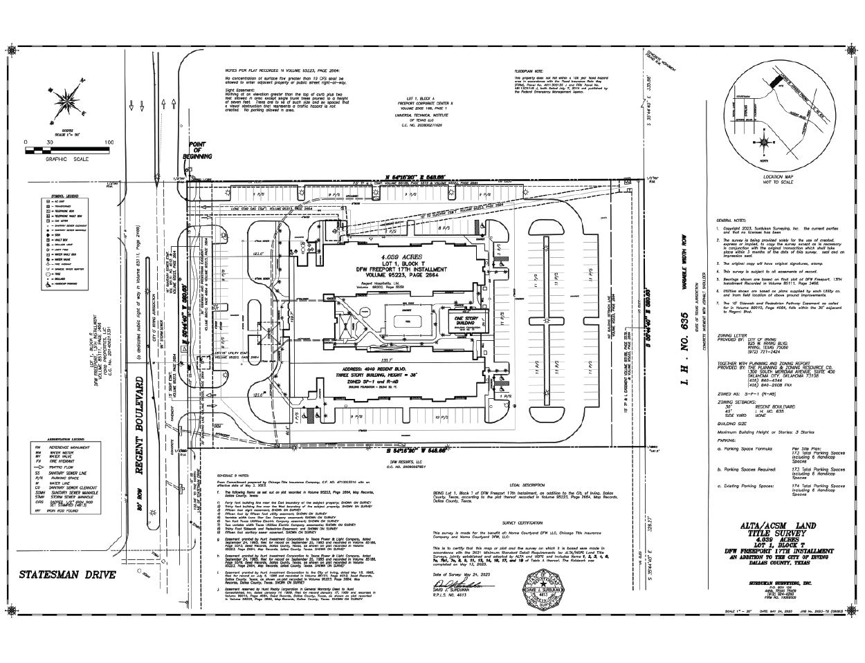
Alta Land Tile Survey
An ALTA Land Title Survey is a very specific type of survey that follows national standards developed by the American Land Title Association in conjunction with the National Society of Professional Surveyors. In addition to locating the boundary of your property, an ALTA Land Title Survey identifies physical features, evidence of possession, and other conditions that could indicate adverse title claims. An ALTA Land Title Survey helps the title company be sure that there is nothing on your land that is going to indicate someone else may have a claim to it, so that you may be able to use the land in the way you intend.
As-Built Survey
An As-Built Survey is a set of record drawings showing the location of improvements on the property “as they were built” during construction in relation to the property line and any easements provided to the surveyor. As-Built Surveys are often required by lenders as proof that a residential home has been built, sometimes called a “House Final” survey.
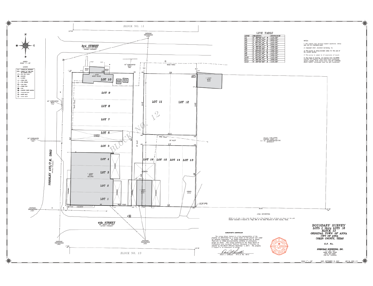
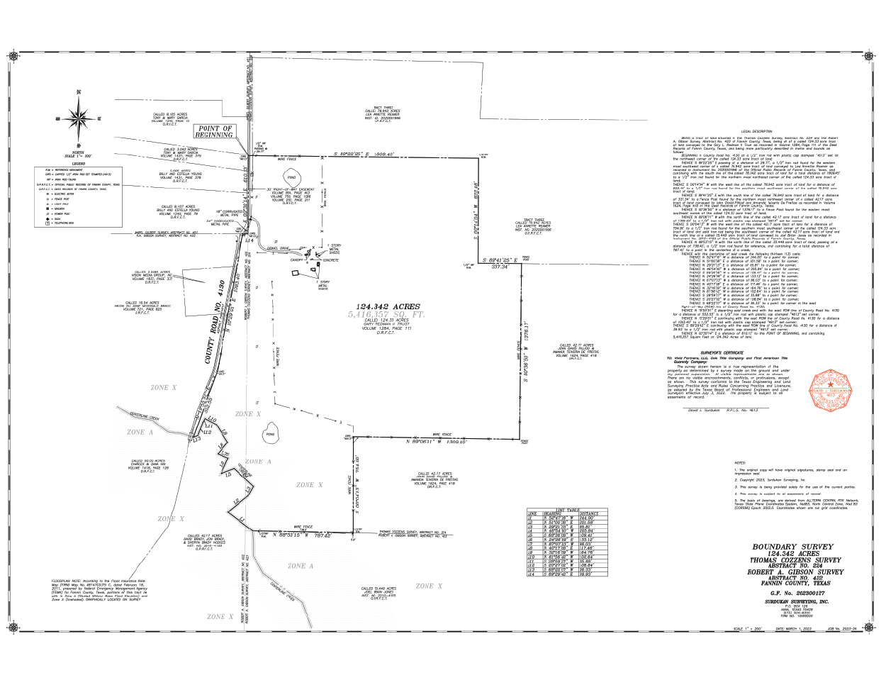
Boundary Line Survey
A Boundary Line Survey is for determining the boundaries between two parcels of land by staking out its corners and establishing the area with monuments. A typical boundary survey’s objective is merely to mark the property’s boundaries. These Surveys may be as simple as marking a property line on the ground or as in depth as illustrating all improvement and natural features with easements and any other important information the client would like to show on the Survey.
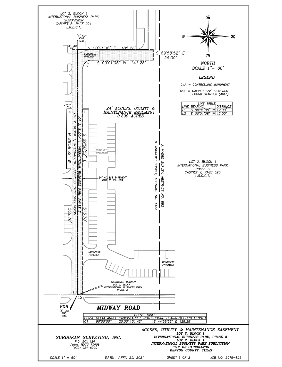
Easement Exhibits
An Easement is the right to use, cross or access another’s piece of land without assuming ownership. Easements are commonly granted to utility companies (Utility Easements) to run various lines across the land. They can also be used for roadways and other uses for access. Some may affect where you can place fences or other structures on your property. An Easement Exhibit shows the boundary line of the Easement in relation to the boundary line of the property and provides a metes and bounds description of the Easement boundary.
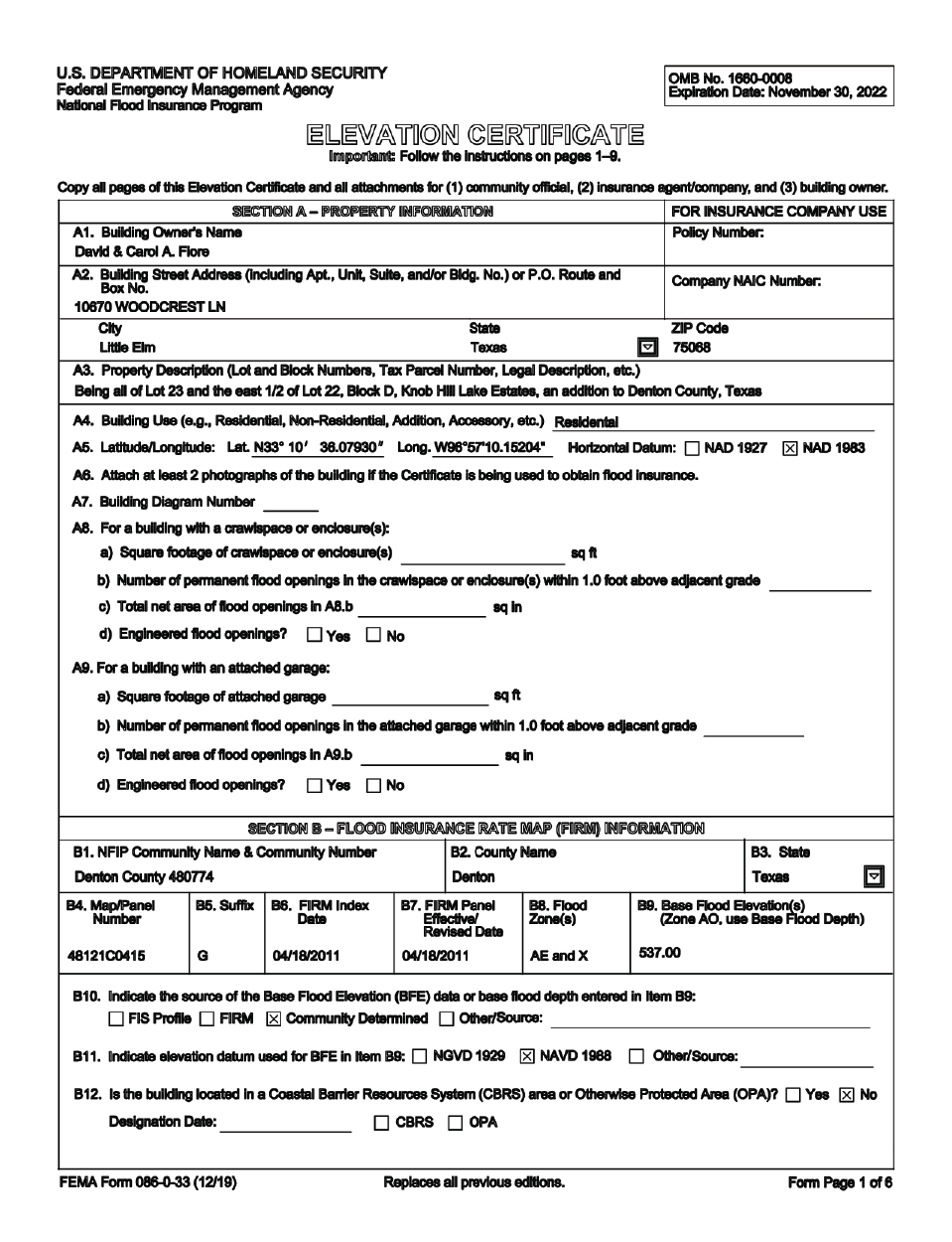
FEMA Elevation Certifications
A FEMA Elevation Certificate is a document completed by a surveyor that informs the homeowner, building department, title company and mortgage company or other entities requiring the form of relevant elevations on the subject property and building. The Elevation Certificate will also include floodplain information including Base Flood Elevation and Flood Zone.
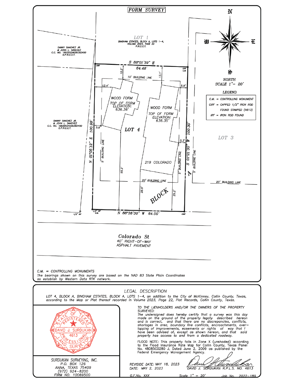
Form Board Survey
A Form Board Survey is used during the construction phase of a project to illustrate the location of the concrete form boards in relation to the property lines, building lines and easements prior to pouring concrete.
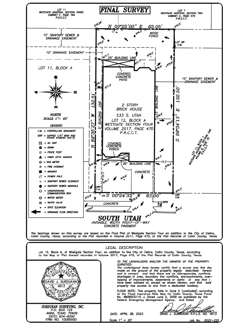
House Final Survey
Also known as an As-Built Survey. House Final Surveys are oftentimes required by lenders as proof that a residential home has been built. A House Final Survey will show the house and all visible improvements in relation to the property lines and any easements provided to the surveyor.
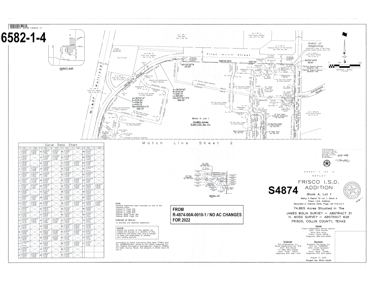
Plats
Plats typically show the boundaries and dimensions of multiple parcels but do not include improvements or constructed features, like buildings. Plats may become documents of records on file at the County Clerk’s Plat Records or at the local City’s Development Department. Filed Plats can also be used to legally designate easements and dedications for roads and other Right-of-Ways. Many Cities have ordinances and require parcels of land to be Platted before they may be developed. Whichever local government entities whose jurisdiction your property falls under will have a predetermined calendar with dates for submitting, reviewing, and accepting Development Plats.
A Few Common Plats:
A Subdivision Plat is created when the owners of a property decide that they want to separate their land into smaller areas of land called lots or parcels. Whether a subdivision involves a simple two lot subdivision that with one acre of land or a more complex thirty lot subdivision with 70 acres of land, a Subdivision Plat will most likely be required.
A Consolidation Plat is created when the owners of two or more parcels of land (usually located within a City’s jurisdiction) decide that they want to combine those properties into one larger tract of land. A Re-Plat is created when two or more platted lots are combined.
A Conveyance Plat is required in some Cities to transfer ownership of a parcel or portion of a parcel of land in order to record the transfer of ownership without requiring construction or design of public improvements or collection of development fees. A Conveyance Plat is for property not previously platted and not intended for immediate development.
Certain Cities have interlocal agreements with their respective counties to dictate development projects within their extra-territorial jurisdiction. These Cities require a Development Plat for property owners to develop. Unlike typical plats, a Development Plat will show all improvements currently on the property as well as the location of proposed developments.
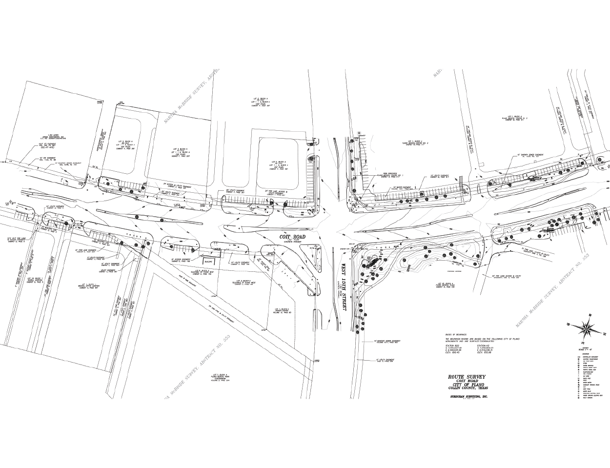
Route Survey
A Route Survey is a data collection operation to gather information about the proposed route of a roadway, utility pipe, or railway. Surveyors are tasked with finding the most cost effective route to follow. An engineer will use the data the survey teams collect to plan out the route in detail and create specifications for work crews to follow.
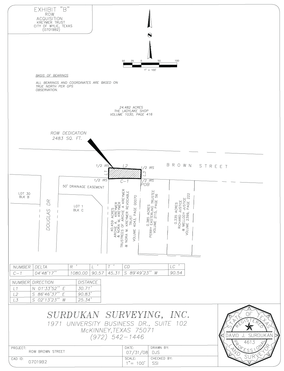
Right-of-Way Dedications
Dedication of right-of-way may be required where existing, proposed or planned public improvements impact a property. Right-of-way is dedicated to the city, county, or government agency by deed and becomes the property of the entity. A Right-of-Way Dedication shows the boundary line of the area to be dedicated in relation to the boundary line of the property and provides a metes and bounds description of the Right-of-Way Dedication.
Title
Title Surveys are oftentimes desired by title insurers to verify existing conditions or issues before insuring. Title Surveys are not always required as a condition by a title insurer. However, without a survey, it’s possible that the title policy will have an exception for what the survey may have revealed. A Title Survey illustrates the relation between the boundary lines and right-of-way access points, buildings, easements, water features, and whatever other man made improvements are found within the boundaries of the property.
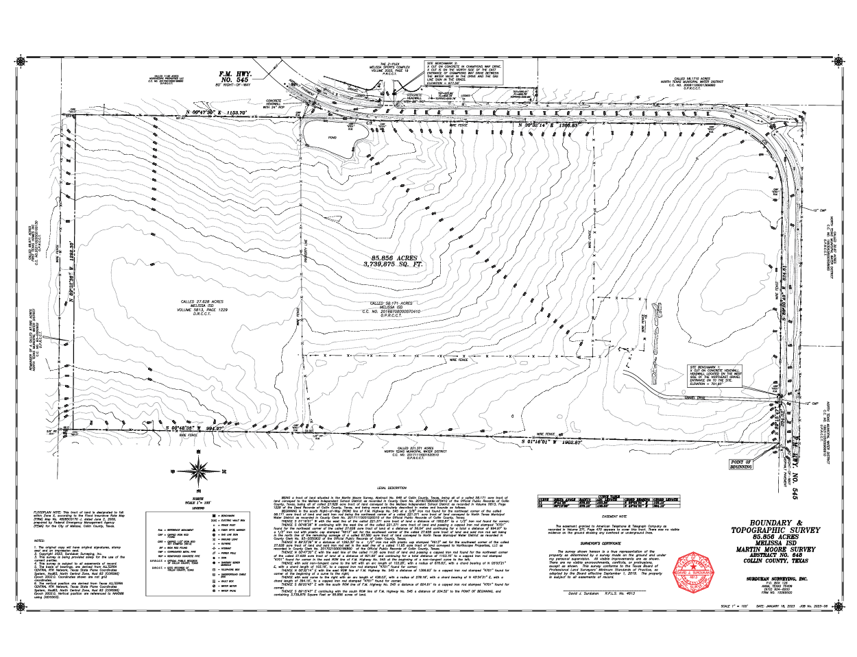
Topographic Survey
A Topographic Survey is an illustration showing the natural and man-made terrain features of the land. A Topographic Survey will show the location of improvements with elevation contours and will reveal permanent features like hills, woodland, rivers, and other structures that would otherwise not be listed on traditional maps and surveys.
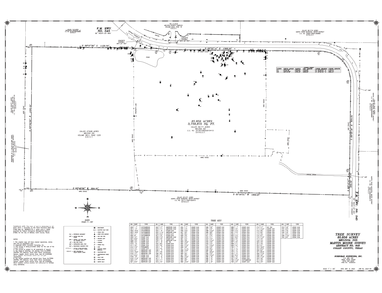
Tree Survey
Tree Surveys are for identifying trees on a piece of land that is currently under consideration for development and illustrating the relation between those trees and the boundary of the land. Tree Surveys are required by many cities as part of the Platting and development process.